Champi is no longer a typhoon: low and front soak Japan on Oct 26-27
The JMA says Champi turned into an extratropical low over the East China Sea at 9:00 p.m. Sunday, Oct. 25, Japan time (12:00 noon in the UK, 8:00 a.m. on the US East Coast), with a pressure of 1000 hPa. The danger is not over: together with a front, the low brings downpours from Kyushu to Kanto. By 6:00 p.m. Monday Japan time the JMA expects up to 250 mm of rain on Shikoku and up to 200 mm in northern Kyushu and Kanto-Koshin.

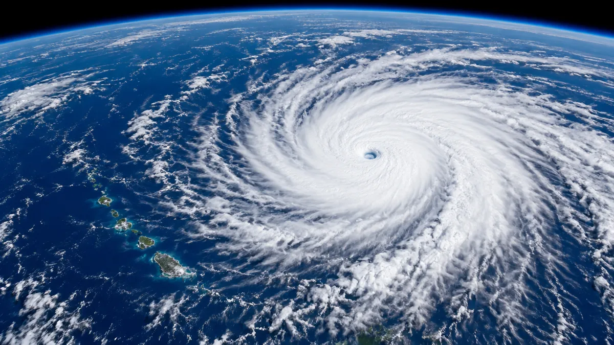
Update Oct. 25, evening: Champi becomes a low, heavy rain from Kyushu to Kanto
According to the JMA, Champi stopped being a tropical cyclone at 9:00 p.m. Sunday Japan time (noon in the UK) and became an extratropical low. Its centre lay over the East China Sea near 31.0°N, 126.0°E, at 1000 hPa, moving north-northeast at 20 km/h. Weaker winds do not mean the end of the trouble: the low has merged with a front and is loaded with moisture.
- Rain: in its 4:48 p.m. Sunday briefing the JMA forecast, for the 24 hours to 6:00 p.m. Monday Japan time (9:00 a.m. UK): Shikoku 250 mm, northern Kyushu and Kanto-Koshin 200 mm, southern Kyushu 150 mm, Kinki 120 mm, Tokai 100 mm, Hokuriku and Chugoku 80 mm. For the following 24 hours to 6:00 p.m. Tuesday: Shikoku 120 mm, Kanto-Koshin 100 mm, Tokai and Kinki 80 mm. Locally 30-50 mm an hour.
- So far: more than 300 mm has fallen in southern Mie Prefecture and on Tsushima (Weathernews, Sunday afternoon).
- Hazards: northern Kyushu faces winds of up to 20 m/s, gusts of 30 m/s and 5 m waves into Monday. The JMA warns of landslides, flooding of low-lying areas and rising rivers, plus thunderstorms, gusts and possible tornadoes.
Update Oct. 25: Champi weakens, heavy rain for Kyushu on Monday
According to the JMA (data for 6:00 a.m. Sunday Japan time, 9:00 p.m. Saturday in the UK), Champi’s centre lay over the East China Sea near 28.6°N, 124.3°E. Pressure has risen to 996 hPa, sustained winds have dropped to 20 m/s (45 mph) and gusts to 30 m/s (67 mph). The storm is moving northeast at 20 km/h and is large, with winds above 15 m/s extending 650 km east and 560 km west of the centre.
- Track: at 6:00 a.m. Monday Japan time (9:00 p.m. Sunday UK) the centre should be about 150 km south-southwest of Goto, and by 3:00 a.m. Tuesday (6:00 p.m. Monday UK) an extratropical low about 130 km south of Cape Muroto on Shikoku. A JMA update at 9:45 a.m., reported by RKK, says the transition may come before Champi even reaches Kyushu.
- Rain: the storm’s clouds and a front are already bringing rain from Kyushu to Tohoku on Sunday. Forecast for the 24 hours to 6:00 a.m. Monday: northern Kyushu 200 mm, Shikoku 150 mm, Chugoku 120 mm, southern Kyushu and Kinki 100 mm, Tokai, Kanto and Hokuriku 80 mm. Downpours and stronger winds hit northern Kyushu from Sunday night.
- Hazards: the JMA urges caution over landslides, flooding of low-lying areas and rising rivers. Winds are easing on Okinawa, but seas remain high.
Update Oct. 24: Taiwan lifts warning, Champi heads for Kyushu
Taiwan’s Central Weather Administration lifted the land warning at 2:30 p.m. Saturday Taiwan time (7:30 a.m. BST), earlier than it had said in the morning. Champi has been downgraded to a tropical storm. At 2 p.m. its center was about 260 km northeast of Taipei, moving northeast at 18-21 km/h with winds of 108 km/h and gusts to 137 km/h. The sea warning should be lifted Saturday evening or overnight.
- Taiwan: fire department figures from Saturday put the toll at 1 dead, a man swept away by waves on Liuqiu island, and 527 injured, mostly in Taipei and Taichung, many hit by falling trees, cables and billboards. Taipower said more than 167,000 homes lost power at the peak, and most are back on. 242 flights were cancelled on Saturday after almost 1,000 on Friday.
- Philippines: Rosal left PAGASA’s area on Saturday morning and Signal No. 1 for Batanes was lifted.
- Japan: at 3 p.m. Japan time (7 a.m. BST) the JMA, via Weathernews, placed Champi about 250 km north of Yonaguni: 985 hPa, winds 30 m/s, gusts 40 m/s, moving north-northeast at 20 km/h. Winds are easing in the Sakishima Islands, but Taketomi has a level 4 landslide alert. On Sunday the storm turns east, by Monday morning it is west of Kyushu, and there it becomes a low tied to a front. Bursts of more than 50 mm an hour are possible, with 200-300 mm around Tsushima and 100-200 mm elsewhere in western and eastern Japan by Monday evening. Seas build near Amami and Kyushu’s west coast from Sunday.
Update Oct. 23, evening: Champi passes Yilan, 350 injured
At 8 p.m. Friday Taiwan time (1 p.m. BST) the center was about 100 km east of Yilan, moving north-northeast at 16 km/h. The Central Weather Administration (CWA) gave sustained winds of 155 km/h (about 96 mph) and gusts to 191 km/h, with a 320 km gale radius. It warned that a landfall cannot be ruled out if the storm stalls or loops.
- Taiwan: as of 7:30 p.m. the Central Emergency Operation Center counted 1 dead and 350 injured, up from 163 six hours earlier. More than 2,600 people were evacuated from mountain areas. Taipingshan in Yilan logged over 500 mm of rain by 7 p.m., Cuifeng Lake over 400 mm, and the CWA expects 600-900 mm in the mountains of New Taipei, Taoyuan and Yilan through Saturday midnight. Saturday is a second straight day off work and school in Taipei, New Taipei, Keelung, Taoyuan, Hsinchu city and county, Taichung, Yilan, Miaoli, Changhua, Nantou, Yunlin and Matsu. All 262 domestic and about 715 international flights were cancelled Friday; domestic flights and ferries stay suspended Saturday. Rain should ease Saturday afternoon, the earliest point warnings could be lifted.
- Japan: violent winds in the Sakishima Islands continue until Saturday morning, then ease. A woman was seriously injured on Miyako (Okinawa Times). Champi turns east over the East China Sea and approaches Kyushu on Sunday and Monday, possibly making landfall as a weaker storm, with heavy rain possible from Kyushu to Kanto on Oct. 25-26.
Update Oct. 23, afternoon: Taiwan and the Sakishima Islands battered
At noon Friday Taiwan time (5 a.m. BST) Champi’s center was about 230 km southeast of Yilan, according to Taiwan’s Central Weather Administration (CWA): 945 hPa, sustained winds of 43 m/s (about 155 km/h) and gusts of 53 m/s (about 191 km/h). Its 320 km gale-force wind field moved over land around 4 a.m. Friday. The storm is turning north and northeast and should be about 150 km northeast of Yilan at 11 a.m. Saturday (4 a.m. BST).
- Taiwan: by Friday afternoon the disaster response center reported 1 death, a man swept away by waves on a beach on Liuqiu island, Pingtung County, and more than 160 injuries, mostly minor ones such as scooter falls. About 90,000 households lost power and roughly 20,000 were still waiting for repairs. 2,639 people were evacuated, including 140 near a landslide-dammed lake on the Wanli River in Hualien. 717 international and all 262 domestic flights were cancelled; most regular trains are suspended, while high-speed rail runs normally. Taiping Mountain in Yilan has had 435 mm of rain since Thursday, and the CWA warns of extreme downpours in the Yilan mountains.
- Japan: at 4 p.m. Japan time (8 a.m. BST) JMA placed the typhoon about 70 km south-southeast of Yonaguni, with 950 hPa, 45 m/s winds and gusts to 60 m/s, moving north-northwest at 20 km/h, Weathernews reported. By 3:30 p.m. gusts reached 51.7 m/s (about 186 km/h) at Ohara on Iriomote and 46.1 m/s (about 166 km/h) on Ishigaki. Miyako had 69.5 mm of rain in one hour and 336 mm in 24 hours. Ishigaki is under a level 4 storm surge warning; seas of 7-8 m could top 10 m overnight. Winds ease Saturday, then Champi turns east toward Kyushu on Sunday and, merging with a front, brings heavy rain to western Japan on Monday.
Update Oct. 23, morning: land warning for all of Taiwan, storm warnings on Ishigaki and Yonaguni
At midnight Friday Taiwan time (5 p.m. Thursday BST, noon EDT) Champi’s center was about 380 km (235 miles) east of Eluanbi, Taiwan’s southern tip. The CWA downgraded it to a moderate typhoon with sustained winds of 43 m/s (about 96 mph), gusts of 53 m/s (about 119 mph) and a central pressure of 945 hPa. The storm-force wind radius is still 320 km, and forward speed has dropped to 12-20 km/h heading north-northwest.
- Taiwan: the land warning has covered the entire main island since Thursday evening. Forecasters expect Champi to slow down or even loop late Friday into Saturday. A direct landfall is not forecast but has not been ruled out. The heaviest rain falls from Friday to early Saturday, with extremely heavy totals in the Yilan mountains and heavy rain in Greater Taipei, the northeast and northern Hualien. Gusts on Lanyu reached Beaufort force 15 and waves off the southeast coast exceed 8 m. On Friday 21 of 22 counties and cities closed offices and schools (only Kinmen is open), Taoyuan airport cancelled 414 flights and the Taipei stock market is shut. By 4 p.m. Thursday officials reported 7 injured and 1 missing. The typhoon should start pulling away Saturday afternoon.
- Japan: according to JMA via Weathernews, at 6 a.m. Friday Japan time (10 p.m. Thursday BST) Champi had 950 hPa, winds of 45 m/s and gusts to 60 m/s, moving northwest at 15 km/h. Yonaguni recorded a 41.7 m/s gust (about 93 mph) at 2:05 a.m. Ishigaki and Yonaguni are under storm warnings. The center passes near Ishigaki and Iriomote from Friday afternoon to early Saturday and will crawl past the Sakishima Islands through Saturday, with waves up to 10 m, gusts of 40-50 m/s and over 300 mm of rain. It may approach Kyushu on Sunday and western Japan on Monday while weakening.
Update Oct. 22, afternoon: Taiwan land warning, Ishigaki evacuation order
Taiwan’s CWA issued a land warning at 11:30 a.m. Thursday local time (4:30 a.m. BST) for Yilan, Hualien, Taitung and Pingtung counties. At 11 a.m. the center was about 520 km east-southeast of Eluanbi (Oluanpi), with sustained winds of 184 km/h (114 mph), gusts to 227 km/h and a storm radius of 320 km, moving northwest at 15-20 km/h.
- Taiwan: work and classes on Orchid Island (Lanyu) and Green Island were suspended from noon Thursday. Taipei, New Taipei, Keelung and Taoyuan will announce Friday closures at 8 p.m. local time (1 p.m. BST, 8 a.m. EDT). 125 flights, mostly domestic, were cancelled Thursday. Nearly 1 m of rain could fall in the northern mountains, and the storm may slow near the island.
- Japan: Ishigaki City issued an evacuation order for the whole city at 4:10 p.m. Japan time (8:10 a.m. BST), and storm warnings are in force for Ishigaki and Yonaguni. The center should pass close to Ishigaki and Iriomote from Friday afternoon to early Saturday. Storm-force wind probability: Ishigaki and Yonaguni 100%, Miyako 99%. Waves near 10 m and over 300 mm of rain. JAL, ANA and Skymark cancelled more than 100 flights from Thursday to Sunday, affecting about 11,000 passengers.
- Philippines: PAGASA’s 5 p.m. bulletin (10 a.m. BST): center about 350 km east of Itbayat, 165 km/h, gusts 205 km/h. Signal No. 2 for Batanes and the northeastern Babuyan Islands, waves up to 12 m.
Update, night of Oct. 21-22: Taiwan sea warning, Ishigaki at 97%
Taiwan’s CWA issued its sea warning at 11:30 p.m. Wednesday (4:30 p.m. BST, 11:30 a.m. EDT) for waters northeast and southeast of Taiwan, including Lanyu and Green Island, and the Bashi Channel. At 11 p.m. the center was about 730 km east-southeast of Eluanbi, with winds of 55 m/s (about 123 mph), a gale radius of 280 km, moving northwest at 14 km/h.
- Taiwan: a land warning may follow around midday or early afternoon Thursday. The center is forecast to stay over the sea east of the island, but with a track error of about 100 km Taiwan is still in range. Peak winds are expected Thursday night into Friday, with heavy rain Friday in the north, Yilan and the mountains, easing Saturday afternoon. The Lanyu buoy has already logged 6-meter waves.
- Japan: the JMA (via Weathernews) put the pressure at 905 hPa at 3 a.m. Thursday Japan time, with 55 m/s winds and gusts to 80 m/s. The Sakishima Islands get the closest pass from Friday afternoon to early Saturday, with gusts of 40-50 m/s and seas over 10 m. Storm-force wind odds: Ishigaki 97%, Yonaguni 96%, Miyako 68%. Miyako has already recorded a 25.9 m/s gust. Western Japan could be in play around Monday, Oct. 26.
- Philippines: in PAGASA’s latest bulletin, Batanes stays under Signal No. 2 and the closest approach to northern Luzon is Thursday afternoon to Friday morning, about 290 km east-northeast of Itbayat at 2 a.m. Friday.
Update, Oct. 21 afternoon: Signal No. 2 for Batanes as Champi passes its peak
PAGASA’s 5 p.m. Wednesday bulletin (5 a.m. EDT, 10 a.m. UK) placed the center about 725 km (450 miles) east of Aparri, Cagayan, with winds of 205 km/h (127 mph), gusts of 250 km/h (155 mph) and movement west-northwest at 25 km/h (16 mph). Strong winds reach out as far as 780 km from the center. JMA, via Weathernews, reported a central pressure of 900 hPa at 3 p.m. Japan time, the lowest of any storm this year.
- Philippines: Signal No. 2 for Batanes, meaning gale-force winds of 62-88 km/h within 24 hours. Signal No. 1 for Cagayan including the Babuyan Islands, eastern Isabela, Ilocos Norte, Apayao and northeastern Catanduanes. The highest possible signal is No. 3. Waves up to 10 m (33 ft) off northern and eastern Batanes and up to 8 m off Cagayan. The storm turns northwest Thursday, north-northwest Friday and recurves north-northeast Saturday.
- Taiwan: at 8 a.m. local time the CWA placed the center about 1,050 km (650 miles) east-southeast of Cape Eluanbi. The forecast track has shifted slightly west. A sea warning could come late Wednesday or early Thursday and a land warning Thursday afternoon or evening. Heavy rain is expected Friday and Saturday in the north, Yilan, Hualien and the central mountains, easing Sunday as the storm heads toward Japan.
- Japan: closest to the Sakishima Islands on Friday, with gusts of 40-50 m/s (90-110 mph) and waves above 6 m (20 ft) already on Thursday. Five-day odds of storm-force winds: Ishigaki 94%, Yonaguni 89%, Miyako 72%. The typhoon may approach western Japan by Monday, Oct. 26, but the timing of its turn is uncertain.
Update, night of Oct. 20-21: Champi speeds up and strengthens
PAGASA’s Bulletin No. 4, issued at 5 a.m. Wednesday Philippine time (5 p.m. Tuesday EDT, 10 p.m. UK), placed the center about 990 km (615 miles) east of northern Luzon. Winds 215 km/h (134 mph), gusts 265 km/h (165 mph), moving west-northwest at 30 km/h. Japan’s JMA reported a central pressure of 920 hPa at 9 p.m. Tuesday Japan time and expects peak strength on Wednesday.
- Philippines: Signal No. 1 for Batanes, the Babuyan Islands, mainland Cagayan, eastern Isabela, northern and central Apayao, northeastern Ilocos Norte and northeastern Catanduanes. The highest possible signal is No. 2 or 3, with No. 3 for the northern Batanes islands. Closest approach: about 340 km (210 miles) east-northeast of Itbayat at 2 a.m. Friday Philippine time (2 p.m. Thursday EDT, 7 p.m. UK). No landfall is forecast. Seas up to 8 m off Batanes and Cagayan, 100-200 mm of rain on Batanes on Thursday. Weakening from Thursday, exit from PAGASA’s area Friday evening or early Saturday.
- Taiwan: the CWA may issue a sea warning Wednesday night, and a land warning Thursday night depends on the track. The turn north should come on Thursday, and the chance of a northeastward swing has grown. The storm will be closest from Friday to Saturday morning. Friday is the wettest day, with heavy rain in the north and east, and waves up to 6 m on the east coast on Thursday.
- Japan: closest to the Sakishima Islands on Friday, with gusts above 140 km/h. Odds of gale-force winds: Ishigaki 86%, Yonaguni 76%, Miyako 64%. Later the storm may head north across the East China Sea toward Kyushu, but that part of the track is uncertain.
Update Oct 20: Champi enters Philippine waters as Rosal
PAGASA says the typhoon crossed into the Philippine Area of Responsibility at 10:40 a.m. Tuesday Philippine time (10:40 p.m. Monday EDT, 3:40 a.m. UK). At 10 a.m. the center was about 860 miles (1,385 km) east of Central Luzon, with 115 mph winds and gusts to 143 mph, moving west-northwest at about 16 mph.
- Philippines: Signal No. 1 covers Batanes, the eastern Babuyan Islands, eastern mainland Cagayan, northeastern Isabela and northeastern Catanduanes - about 36 hours before strong winds arrive. It may rise to No. 2 or 3 as Rosal nears northern Luzon. PAGASA expects weakening from Thursday and an exit on Saturday.
- Taiwan: at 8 a.m. Taiwan time (8 p.m. Monday EDT, 1 a.m. UK) the CWA measured 123 mph winds and 152 mph gusts. The typhoon should turn north from Thursday near Japan’s Ishigaki Island, so a direct hit is not forecast. A sea warning could come late Wednesday night or Thursday morning and a land warning Thursday night. Heavy to extremely heavy rain is possible Friday and Saturday in the north, Yilan and Hualien.
- Japan: JMA tracks it as Typhoon No. 30. The closest pass to the Sakishima Islands is expected around Friday, with gusts above 90 mph possible. JMA puts the chance of storm-force winds within five days at 94% for Ishigaki, 89% for Yonaguni and 74% for Miyako. A weekend turn toward western Japan is possible but not certain.
Update Oct 19, evening: Champi is a super typhoon again
PAGASA says Champi regained super typhoon strength at 2 p.m. Monday Philippine time (2 a.m. EDT, 7 a.m. UK). The 5 p.m. bulletin (5 a.m. EDT, 10 a.m. UK) put the center about 940 miles (1,515 km) east of southeastern Luzon, with 115 mph winds, 143 mph gusts and 940 hPa, moving west-northwest at about 9 mph.
- Philippines: it enters PAGASA’s area Tuesday morning or early afternoon Philippine time (Monday evening EDT, overnight or early Tuesday UK) and takes the local name Rosal. It should head west through Wednesday, turn northwest from Thursday and leave the area on Saturday, Oct. 24.
- Wind signals: PAGASA now expects Signal No. 2 or 3 at most, down from 3 or 4, for the northern and eastern parts of Northern Luzon and parts of Bicol. A trough linked to the typhoon is already bringing heavy rain to eastern Southern Luzon and the Visayas, including Catanduanes and Samar on Tuesday.
- Strength: peak over the Philippine Sea, slow weakening from Thursday.
- Taiwan: no change from the CWA - a sea warning is possible Wednesday night and a land warning Thursday night or Friday, with the biggest impact Friday and Saturday. Its latest map shows a turn north off the east coast, but the track is still uncertain.
Update Oct 19: Champi is intensifying again
PAGASA advisory No. 4, issued 11 a.m. Monday Philippine time (11 p.m. Sunday EDT, 4 a.m. UK): the center was about 995 miles east of southeastern Luzon, with sustained winds of 110 mph, gusts of 134 mph and a central pressure of 945 hPa, moving west-northwest at 12 mph. It is forecast to regain super typhoon strength by Monday evening.
- Philippines: entry into the PAGASA area on Tuesday morning or early afternoon local time (Monday evening to late Monday night EDT), when it gets the local name Rosal. Wind signals for northern and eastern Northern Luzon and parts of Bicol may be raised as early as Monday evening, peaking at Signal No. 3 or 4. Gusty winds over most of Luzon and the Visayas from Wednesday, with hazardous seas off eastern Luzon.
- Batanes: the forecast track keeps the center east of the islands - about 215 miles east-northeast of Itbayat at 8 a.m. Friday local time (8 p.m. Thursday EDT, 1 a.m. Friday UK), with winds near 110 mph.
- Taiwan: the CWA may issue a sea warning Wednesday night and a land warning Thursday night or Friday. The biggest impact is expected Friday and Saturday, with heavy rain in the north, the center and Yilan and Hualien counties. Some models show landfall in eastern Taiwan, others a turn north before the island.
Update Oct 18, evening: Champi heads toward the Philippines and Taiwan
Guam is through the worst, and Champi is now out over open water. PAGASA’s bulletin at 11 p.m. Sunday Philippine time (11 a.m. EDT) put the storm about 1,140 miles east of southeastern Luzon, moving west-northwest at 9 mph. It has dipped to 110 mph, but a new round of strengthening is expected.
- Philippines: once inside PAGASA’s area on Tuesday it will be called Rosal. Wind signals could go up over northern Luzon and parts of Bicol from Monday evening or Tuesday morning, with No. 3 or 4 the highest expected. Heavy rain is forecast for extreme northern Luzon from Wednesday, with dangerous seas on the eastern seaboard.
- Batanes: PAGASA’s track has the center about 165 miles east-northeast of Itbayat at 8 a.m. Friday, Oct. 23.
- Taiwan: the Central Weather Administration expects Champi to hold its strength toward waters northeast of the island, and some models show landfall in eastern Taiwan. Northern and central Taiwan plus Yilan and Hualien face heavy rain. The track is still uncertain: Tuesday should show whether it turns north first.
On Guam, the NWS plans to survey the southern villages closest to the eye on Monday.
Update Oct 18, afternoon: Super Typhoon Champi has passed Guam
Guam avoided a direct hit. The roughly 5-mile-wide eye passed about 10 miles south of the island’s southern tip at 4:26 a.m. Sunday Guam time, just as Champi was upgraded to a super typhoon with 150 mph winds. NWS Guam said a landfall would have been devastating.
- Winds: most of Guam saw tropical storm winds with typhoon-force gusts. The airport gusted to 80-85 mph, and gauges at Apra Harbor and Pago Bay never logged sustained 74 mph winds.
- Rain: 1 to 3 inches by midday Sunday, well below the 8 to 14 inches forecast.
- Damage: preliminary reports show no widespread significant damage. NWS will survey far southern Guam on Monday. No injuries or deaths have been reported.
- Surf: until 4 a.m. Monday, 18 to 25 ft surf on east and south reefs and 4 to 6 ft of inundation are possible.
- Readiness: Guam stays in COR 1 until the governor announces COR 4. Warnings for Saipan and Tinian were canceled at 11 a.m. Sunday.
At 11 a.m. Sunday, Champi was about 95 miles west-southwest of Guam, heading west-northwest at 16 mph.
Update Oct 18: Category 4 Champi at Guam’s doorstep
Champi jumped from Category 2 to Category 4 in less than a day. At 7 p.m. Saturday Guam time it had 130 mph sustained winds about 140 miles east-southeast of the island. By 4:40 a.m. Sunday local time (2:40 p.m. Saturday EDT), FOX Weather reported 140 mph winds with the center roughly 55 miles southeast of Guam.
- Extreme Wind Warning: NWS Guam issued it for southern Guam at 3:52 a.m. local time, for winds of 115 to 135 mph.
- Track: the center is expected to pass just south of Guam, but the eyewall could sit over the southern villages.
- Ocean: waves up to 35 feet and 5 to 7 feet of coastal flooding, worst on east and south shores.
- Rain: 8 to 14 inches, with a flash flood warning.
- Readiness: Guam is in COR 1; residents should stay in concrete shelter until COR 4 is declared. Rota has a typhoon warning, Tinian and Saipan a tropical storm warning.
No official reports of casualties or damage had been released at the time of writing. We will update this page as Guam authorities report.
Update Oct 17: Champi is a typhoon
NWS Guam advisory 11, issued at 1:06 p.m. Saturday, October 17, local time (11:06 p.m. Friday EDT), put Champi at 100 mph sustained winds, a Category 2 typhoon. The center was about 225 miles east-southeast of Guam, moving west-northwest at 18 mph. Forecasters expect it to slow, bend slightly west and pass just south of the island on Sunday morning as a Category 3.
- Size: typhoon-force winds reach out 40 miles from the eye, tropical-storm-force winds about 125 miles.
- Guam and Rota: typhoon warning. Damaging winds from Saturday evening, typhoon-force winds from early Sunday (local time).
- Tinian and Saipan: tropical storm warning and typhoon watch.
- Sea: NWS warns of waves up to about 35 feet near the eyewall. Ports in Guam and the CNMI are closed under condition ZULU.
Guam opened five school shelters at 10 a.m. Saturday local time, with room for 1,964 people. Residents of tin-roof or container homes were told to move early.
Update: red alert
The NWS advisory issued at 1 a.m. ChST on Saturday, October 17 (15:00 UTC Friday) placed Champi about 420 miles (675 km) east-southeast of Guam, moving west at 15 mph with sustained winds near 70 mph (113 km/h). GDACS models a peak of up to 250 km/h (155 mph).
- Guam and Rota: typhoon warning. Rota should get lesser but still damaging winds on the outer side of the storm.
- Tinian and Saipan: tropical storm warning and typhoon watch - only the edge of Champi is expected to graze them.
- Guam and the Northern Marianas: flood watch.
Where Champi is now
In the NWS briefing at 1 p.m. Chamorro Standard Time on Friday, the center was about 590 miles east-southeast of Guam, moving west at around 24 mph. Sea surface temperatures of 29-30°C give it plenty of fuel to intensify.
Warnings in the Marianas
- Guam and Rota: typhoon warning.
- Saipan and Tinian: typhoon watch.
- All four islands: flood watch.
Governor Lou Leon Guerrero moved Guam to Condition of Readiness 2.
Rain and surf
NWS forecasts 6 to 12 inches (152-305 mm) of rain. Surf could build to 15-20 feet on Sunday morning, with 2-3 feet of coastal inundation possible on exposed shores. Model tracks still range from south of Guam to the north of the island and the Guam-Rota channel, so small shifts matter.
See it live
FAQ
What time will Champi reach Kyushu in UK and US time?
Champi will not arrive as a typhoon any more: at 9:00 p.m. Sunday, Oct. 25, Japan time (noon in the UK, 8:00 a.m. US Eastern) it became a low over the East China Sea. The low moves north-northeast and nears Kyushu on Monday, Oct. 26. Western Japan gets the most rain until 6:00 p.m. Monday Japan time (9:00 a.m. UK, 5:00 a.m. US Eastern), while Tokai and Kanto stay wet into Tuesday, Oct. 27.
How strong is Champi now?
Champi peaked on Wednesday, Oct. 21 (900 hPa per the JMA, the lowest pressure of the year) and passed Guam as a super typhoon. At 9:00 p.m. Sunday Japan time the JMA reclassified it as an extratropical low of 1000 hPa. Winds are far weaker (up to 20 m/s, 45 mph, with 30 m/s gusts in northern Kyushu), but the low carries a lot of moisture and the risk now is flooding rain and landslides.
Where can I follow official warnings?
Warnings for Guam and the Northern Mariana Islands come from the National Weather Service in Guam, and the Joint Typhoon Warning Center publishes the official track. Zenitmap shows live clouds and wind, but act on what those agencies say.
Sources
- NWS Guam - National Weather Service Guam
- JTWC - Joint Typhoon Warning Center
- GDACS - Tropical Cyclone CHAMPI-26
- Isla Public - NWS briefing 16.10.2026
- NWS Guam - Typhoon Champi Advisory 11 (17.10.2026)
- Guam Homeland Security / OCD - JIC Release No. 4 (17.10.2026)
- Guam Daily Post - Champi now a Category 4 (17.10.2026)
- FOX Weather - Violent Typhoon Champi (17.10.2026)
- Guam Daily Post - Champi became super typhoon passing Guam (18.10.2026)
- Marianas Press - Super Typhoon continues its movement away (18.10.2026)
- PAGASA - Tropical Cyclone Advisory No. 2 (18.10.2026)
- GMA News - PAGASA 11 p.m. bulletin (18.10.2026)
- Focus Taiwan - CWA: Typhoon Champi sea warning possible Wednesday night (18.10.2026)
- Philstar - Champi seen entering PAR (18.10.2026)
- PAGASA - Tropical Cyclone Advisory No. 4 (19.10.2026, 11:00 PHT)
- Philstar - Champi may regain super typhoon strength before entering PAR (19.10.2026)
- Taipei Times - Typhoon Champi sea warning possible Wednesday (19.10.2026)
- PAGASA - Tropical Cyclone Advisory (19.10.2026, 17:00 PHT)
- GMA News - Champi intensifies anew into super typhoon (19.10.2026)
- DZRH - Champi reintensifies into a super typhoon, to enter PAR on Oct. 20 (19.10.2026)
- The Manila Times - Champi re-intensifies into super typhoon (19.10.2026)
- ICRT - Sea warning for Typhoon Champi possible by Wednesday night (19.10.2026)
- SunStar / PNA - Signal No. 1 up in parts of Northern Luzon due to Rosal (20.10.2026)
- Philstar - Champi reintensifies as super typhoon (20.10.2026)
- Focus Taiwan - Typhoon Champi's effect on Taiwan to be strongest Friday, Saturday: CWA (20.10.2026)
- Focus Taiwan - Typhoon Champi to turn away from Taiwan, will still bring heavy rain (19.10.2026)
- Weathernews - 台風30号(チャンパー) 沖縄接近 進路は北寄りに (20.10.2026)
- PAGASA - Tropical Cyclone Bulletin No. 4, Super Typhoon Rosal (21.10.2026, 5:00 PHT)
- Philstar - Rosal slightly intensifies, Signal No. 1 still up in Luzon (20.10.2026)
- ASTIG - Rosal: Signal No. 1 in 7 areas, possible Signal No. 3 over Batanes (21.10.2026)
- Taipei Times - Sea warning expected for typhoon (21.10.2026)
- Weathernews - 猛烈な台風30号(チャンパー) 週後半に沖縄接近 (20.10.2026)
- Philstar - Signal No. 2 still up in Batanes as Super Typhoon Rosal slightly weakens (21.10.2026)
- Taipei Times - Northern Taiwan to see rain as Typhoon Champi approaches (21.10.2026)
- Weathernews - 台風30号(チャンパー)は猛烈な勢力維持 沖縄では早めの警戒を (21.10.2026)
- CNA - 颱風薔琵海上警報發布 最快22日中午前後發陸警 (22.10.2026)
- UDN - 薔琵發布海警 估明午後發陸警 (22.10.2026)
- Focus Taiwan - Sea warning for Typhoon Champi possible overnight: CWA (21.10.2026)
- Weathernews - 大型で猛烈な台風30号(チャンパー) 沖縄・先島諸島にかなり接近へ (22.10.2026)
- PAGASA - Tropical Cyclone Bulletin No. 6, Super Typhoon Rosal (21.10.2026, 17:00 PHT)
- Taiwan News - Taiwan issues land warning for Typhoon Champi (22.10.2026, 11:30 TST)
- Focus Taiwan - Taiwan issues land warning as Typhoon Champi approaches (22.10.2026)
- Taipei Times - Taiwan issues land warning as Typhoon Champi approaches (22.10.2026)
- Reuters (AOL) - Taiwan issues land warning ahead of arrival of powerful Typhoon Champi (22.10.2026)
- Weathernews - 大型で非常に強い台風30号(チャンパー) 先島近海はすでに大荒れ (22.10.2026, 15:00 JST)
- NHK - 石垣市全域に避難指示 (22.10.2026)
- PAGASA - Tropical Cyclone Bulletin No. 10, Typhoon Rosal (22.10.2026, 17:00 PHT)
- Philstar - Signal No. 2 remains in 2 areas as Super Typhoon Rosal weakens (22.10.2026)
- CNA - 颱風薔琵來襲 23日停班停課情況一覽 (22-23.10.2026)
- UDN - 薔琵海陸警發布 全台6縣市一級開設 (22.10.2026)
- UDN - 中颱薔琵來犯 停班停課資訊 (22.10.2026)
- ETtoday - 薔琵暴風圈將觸陸 恐剎車打轉 (23.10.2026, 00:48 TST)
- Newtalk - CWA 00:15 海陸警報 (23.10.2026)
- Weathernews - 台風30号(チャンパー) 今日23日(金)は先島諸島に最接近 (23.10.2026, 05:46 JST)
- Yam News - CWA bulletin 13-1 (23.10.2026, 12:00 TST)
- Storm Media - 薔琵暴風圈觸陸 (23.10.2026)
- CNA - 颱風薔琵襲台 輕傷人數增 (23.10.2026)
- China Times - 薔琵颱風 1死171傷 (23.10.2026)
- Weathernews - 先島諸島は台風30号(チャンパー)接近で大荒れ (23.10.2026, 16:00 JST)
- Taipei Times - Typhoon Champi shuts down Taiwan (24.10.2026)
- tenki.jp - 台風30号と前線 (23.10.2026)
- Focus Taiwan - Land warning for Champi lifted as typhoon downgraded to tropical storm (24.10.2026)
- Reuters (Arab News) - Typhoon Champi sweeps past Taiwan, one dead and 500 injured (24.10.2026)
- Inquirer - Typhoon Rosal exits PAR on Saturday morning (24.10.2026)
- Weathernews - 台風30号(チャンパー)は北上 西〜東日本は大雨警戒 (24.10.2026, 15:00 JST)
- tenki.jp - 台風30号(2026年) 最新位置・進路予想 (25.10.2026, 6:45 JST)
- tenki.jp - 九州から関東は大雨のおそれ (25.10.2026)
- RKK熊本放送 (Yahoo!ニュース) - 気象庁25日午前9時45分発表
- tenki.jp - 台風30号は温帯低気圧に変わりました (25.10.2026, 22:00 JST)
- Weathernews - 台風30号(チャンパー) 明日は温帯低気圧に変わりながら九州接近 (25.10.2026, 15:00 JST)
- 気象庁 全般気象解説情報 25日16時48分 (via uniquerui.com)
- JMA - 台風情報
All guides
 Cyclone Arnab heads for India: landfall in Andhra Pradesh expected Wednesday morning
 Deep M6.5 earthquake near the Bonin Islands, Japan - October 25, 2026
 Vanuatu earthquake: M6.9 quake and tsunami warning on October 24, 2026
 Earthquake in Italy today: M5.0 off the Aeolian Islands near Sicily on October 23, 2026