
Free maps to download and use
Our event maps are free to use in news articles, lessons, presentations and social posts, commercial use included. All we ask is a credit: "Map: Zenitmap". Every map is drawn from official data within minutes of the event.
How to credit
Put this line next to the map or under it. Online, link the word Zenitmap to zenitmap.com. In print or on TV, the text alone is enough.
Map: Zenitmap (zenitmap.com), data: USGSLatest event maps
New maps appear here after every strong earthquake, tropical cyclone, eruption or geomagnetic storm. Pick a format and download.


Champi is no longer a typhoon: low and front soak Japan on Oct 26-27
October 25, 2026 · data: GDACS (© EU)


Cyclone Wati reaches Category 2 as Aitutaki braces for damaging winds on Sunday
October 17, 2026 · data: GDACS (© EU)


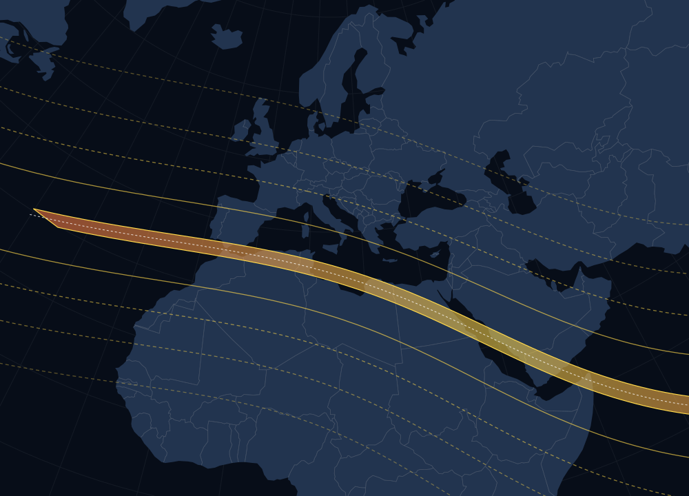
Total solar eclipse of 2 August 2027: path map
A clean vector map of the path of totality over Spain, North Africa and the Middle East, with lines showing how much of the Sun will be covered elsewhere. No labels, so you can add your own in any language.
⬇ Download SVGWhat you can do
- Publish the maps in articles, newsletters, presentations, lessons, videos and social posts.
- Use them commercially, for example on a news site with ads or in a paid report.
- Crop and resize them or add your own captions. If you change what the map shows, mention that it was modified.
- The licence is Creative Commons Attribution 4.0 (CC BY 4.0). You don't need to ask us first.
What this does not cover
- Webcam images. They belong to the camera owners we name next to each camera.
- The illustrations at the top of our guides.
- Our logo on its own, or any suggestion that Zenitmap endorses your publication.
The maps use public data: earthquakes from the USGS, cyclones, floods, wildfires and eruptions from GDACS (© European Union), geomagnetic activity from NOAA SWPC and land outlines from Natural Earth. Please keep the data source in the credit. CC BY 4.0
Live widgets for your website
Want live data instead of a static picture? Paste one of our free widgets into your page. They update on their own.
Press contact
Need a map of a specific place, a higher resolution or a quick comment on an earthquake, the aurora or space weather? Write to [email protected]. During major events we usually reply within a few hours.
Questions
Are the Zenitmap maps really free?
Yes. You can use the event maps on this page for free, commercially too, under CC BY 4.0. The only condition is a credit, for example "Map: Zenitmap (zenitmap.com), data: USGS".
Do I have to link to Zenitmap?
Online, a link to zenitmap.com is the usual way to credit us and we appreciate it. In print, on TV or anywhere a link isn't possible, the text credit is enough.
How fast is a map ready after an earthquake?
Our system checks the official feeds every few minutes. Maps are made automatically for earthquakes of magnitude 6 or more (5 or more in Europe), orange and red GDACS alerts, and geomagnetic storms of G3 or stronger. The latest ones appear on this page together with an article.
Can I get a map in another size or language?
The horizontal version has no text, so it works in any language. If you need another size or a map of a specific region, write to [email protected].